

County Reshapes Landscape for Climate Change
Shade and reshaped river banks are key parts of the plan.


Orange County Planning Commission is in the process of updating their comprehensive plan, anticipating a public hearing in November, said Orange County Planning Commissioner Alan Sorensen. Along with this effort, the Commission is preparing for climate change with the Orange County Resilience Plan.
While more tornadoes “could occur,” Sorensen said, the focus is on extreme heat and flooding. For heat protection, green infrastructure is the strategy. Parking lots will have curbed “landscape islands” planted with shrubs and trees.
“They’re noticeably cooler,” he said.
Urban “heat islands,” with their paved roads and concrete sidewalks, will get more shading from a variety of deciduous trees. New York State Department of Environmental Conservation will guide that strategy to reduce loss from invasive species, Sorensen said.
The plan also aims to reduce impervious surfaces, like paved parking lots. For example, he said, a warehouse plan that includes 100 parking spaces may only have 65 spaces, with land set aside for 35 more if needed. Farmland and wetland preservation is part of the plan too.
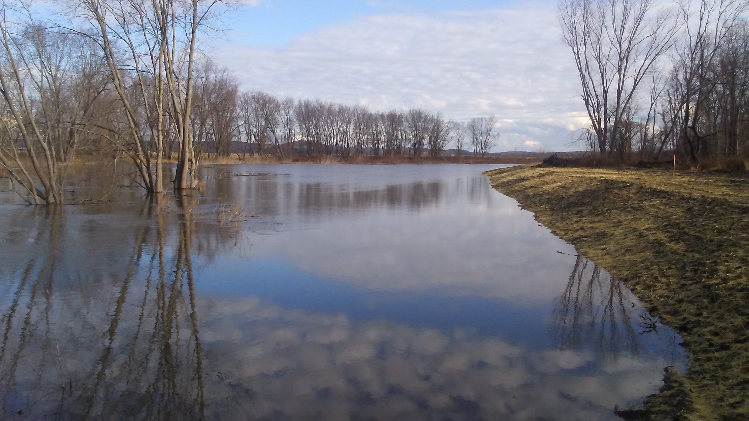
As for preventing flooding, the strategy includes prohibiting development on land prone to flooding and floodplain “benching” along the Wallkill River, which allows cresting water to spread on the floodplain, reducing damage downstream.
Kevin Sumner, Orange County Conservation District manager, is on the steering committee for the Climate Resiliency Plan, working with a private consultant.
“Many landowners are frustrated by frequent flooding along the Wallkill River,” said Sumner, particularly midsummer floods. Hurricane Irene caused $50 million in damage at the end of August in 2011.
So the focus is on floodplain benching along the Wallkill River, where flooding has too often ruined crops in the agricultural Black Dirt region that includes areas of Warwick, Goshen, Minisink and Wawayanda. Because flood runoff water may carry bacteria, it renders produce unfit for sale.
“Some farms were getting flooded two or three times a year,” said Sumner. “They were getting ten-year storms yearly,” meaning 4.5-5 inches of rain in 24 hours. Benching could contain that.
“When we started working on protecting the agricultural area, deepening the river was suggested, but it fills with sediment,” he said. “You can’t stop the flooding, but you can reduce the consequences. For benching, farmers give a little land back to the river. They want quick action, but government is slow. It takes time. A design, construction and funding plan is needed.”
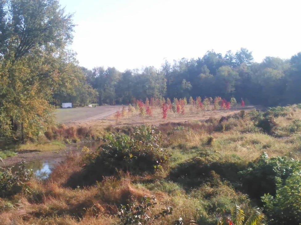
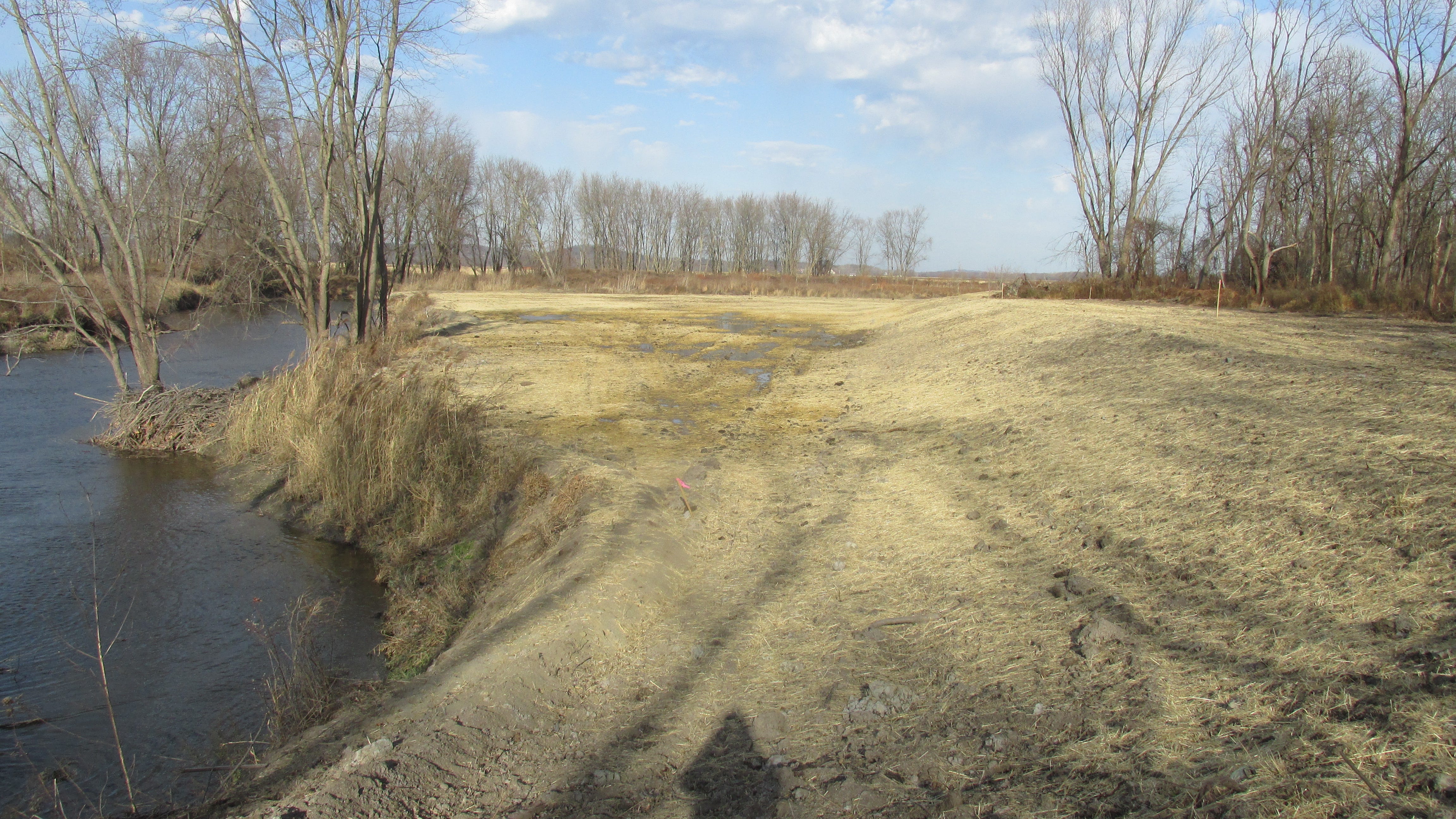
Benching involves excavating soil on both sides of the river, so water is let out early in a flood. Beginning in 2016, along three quarters of a mile of the Wallkill River, from the Pochuck Creek to Route 1, a strip of river bank up to 130 feet wide was lowered by as much as 10 feet on each side of the river by removing large quantities of soil. Then a variety of native trees, grasses and other wildflowers with deep roots were planted to prevent erosion.
“People thought the trees would die, but they adapted to the floodplain,” said Sumner. The trees planted included willows, silver maple, red ash and oak.
As for grasses and wildflowers, he said, “Sometimes what you plant comes up, sometimes not. Permit conditions included planting trees, and planting trees helped with getting funding.”
The benching project began in 2013. Since then, most of $4 million has been spent on benching three quarters of a mile along the Wallkill River, with more than three additional miles planned. While $3 million came from New York State, $350,000 came from Orange County, and $650,000 from Orange County Soil and Water Conservation District. Sumner expects the entire four mile project to cost $10-12 million.
The benching project has been in progress for a decade, “with far-reaching effects,” Sumner said. “Because the area is flat, it naturally wants to flood. If a tree falls in, the water backs up. Now we want to increase the benefits with tributaries. This summer flooding was on Quaker Creek but not on the Wallkill. So we’ll shift attention to the tributaries.”
Quaker Creek is one of three Wallkill River tributaries in the area that also includes Rutgers and Pochuck Creek.
“Quaker Creek does lots of crop damage,” Sumner said. “Maybe next year we’ll do a mini-bench there. The Quaker Creek valley is clear to the stream, with no trees. So there’s no tree replacement. We’ll do an herbaceous cover with a small flood control bench.”
Broken Dikes at Wallkill River Wildlife Refuge
Meanwhile, dikes at the Wallkill River Wildlife Refuge are “not functional,” Sumner said, and he hopes to collaborate with refuge administrators on benching, as federal money is available to address flooding there.
“Collaborating with the refuge would enhance the refuge while mitigating for farms that drain through the refuge,” Sumner said. “ There is severe erosion on the river side of some of the dikes. This can be partially attributed to higher river flow velocities caused by the dikes and by the incised condition of the Wallkill channel in places.
”Adding benching to removal of the dikes would release flood flows even more frequently, more like the seasonally flooded meadow scenario described in historical accounts of the area before extensive ditching and draining. This would enhance the overall functioning of the benching system we are working on . It would also create multiple opportunities for the Refuge managers to refine management of the Refuge via various methods involving collecting, holding and releasing river overflows using water control structures to enhance conditions for certain flora and fauna.”
Wallkill River Wildlife Refuge Manager Michael Horne has acknowledged problems with the dikes.
“The dikes have been used historically, but the dike configuration on the river is hard to maintain,” he said.
Federal funding is available to repair the dikes, he said. Benching is also a possibility. The U.S. Department of Transportation has committed $4-5 million to the Refuge to address flooding, and Sumner and Horne discussed applying the funds to benching. But no agreement was reached.
“It would be nice to focus on the work instead of chasing dollars,” Sumner said.
Other Forces in Flooding
Sumner also attributes flooding to development in the watershed that generates impervious surfaces, resulting in runoff into the Wallkill River.
“Laws require controlling development for storm water, but laws don’t ensure accomplishment. The degree of implementation varies between municipalities,” he said. “The Wallkill has a reputation for muddy, polluted streams, with sediment as primary pollutant. But how much is from the banks, and how much from development and farms?”
Rebar stakes in the river banks are being used to measure the contribution of erosion to muddy water, as vegetation holds the banks in place.
Farmer Feedback
At first, Sumner heard some doubt about whether benching would work.
“But growers along the river report improvement,” he said. “There have been enough storms to see a difference. ”
“I wish benching had happened 25 years ago,” said Warwick farmer Leonard DeBuck, who grows corn, soybeans, hay, sod and vegetables. “We’ve occasionally had to run pumps in the last six years to avoid flooding, but we haven’t had heavy losses since the benching, especially where the bench carries heavy flows from Rutgers Creek.”
He recalled “almost being driven to the bank” by financial losses because of flooding from Hurricane Irene.
He described how the Wallkill “meanders” slowly north, while Rutgers Creek, when full of rainwater, has created a torrent moving southeast, opposing and flooding the river.
“We ran pumps for five to eight days then,” said DeBuck. “Now we only run pumps for 24 hours.”
Community focused news can only succeed with community support. Please consider the various subscription levels.